Just a short hop from downtown Silver City is a remarkable urban hike that combines a lush riparian area, classic high desert vegetation and reminders of Silver City’s rich history.
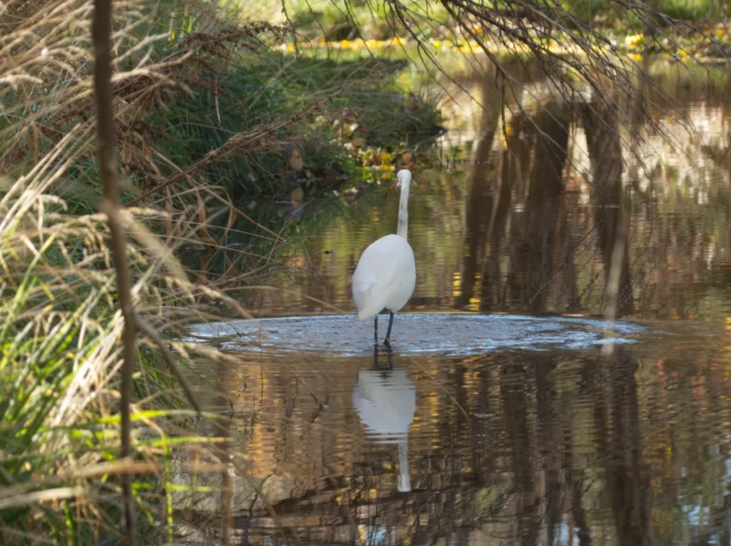
The San Vicente Arroyo is a big draw for wildlife, and it’s not uncommon to see great egrets, black hawks and great blue herons fishing for dinner along the creek.
You may encounter a herd of alpine goats along the way, but despite their impressive horns, they are very friendly and will follow you asking for scritches.
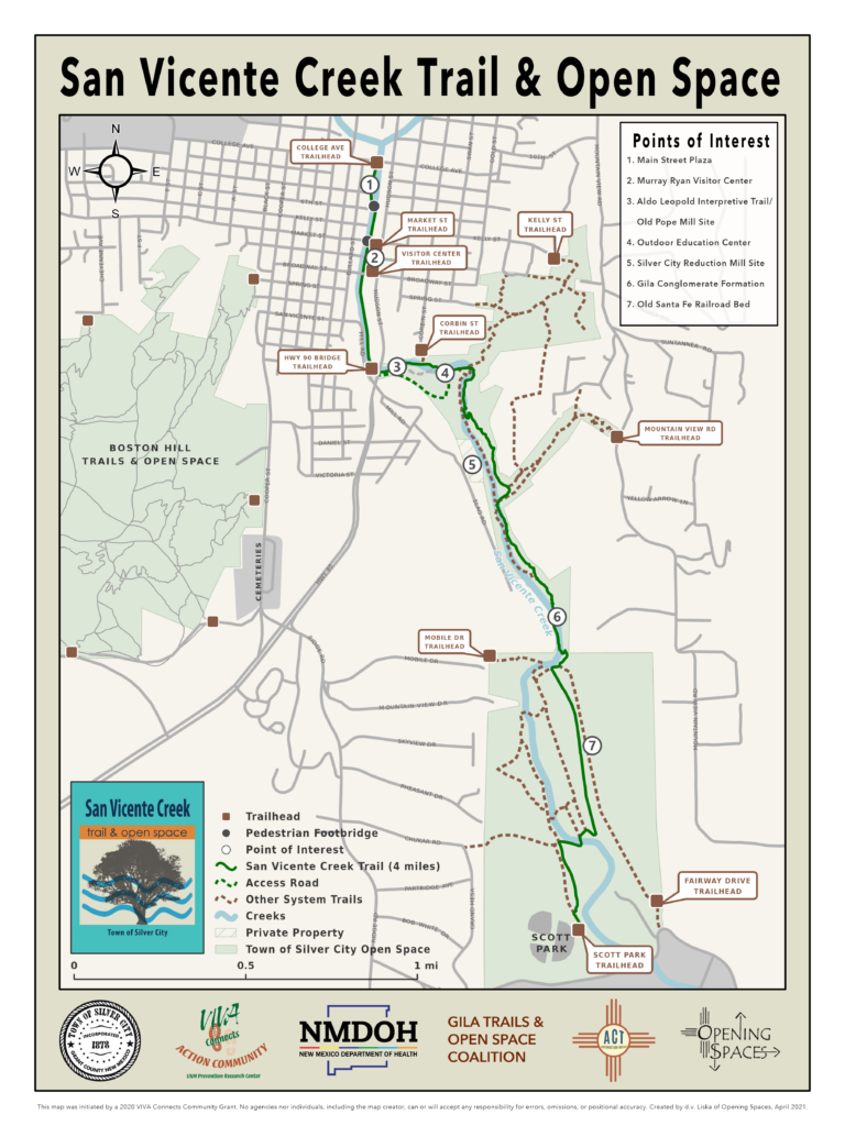
There are signed trailheads at College Avenue, Market Street, Kelly Street, the Silver City Visitor Center, the Highway 90 bridge, Corbin Street, Mountain View Road, Mobile Drive and Fairway Drive (see map below).

Photo Gallery
Favorite San Vicente Creek Hikes
San Vicente Loop from Mountain View
Abundant shade and a permanent stream make this trail a great choice for year ’round use.
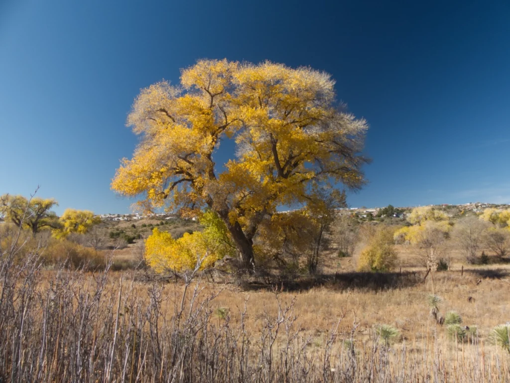
This route starts at a public parking lot on Mountain View Road. It descends a well-marked trail through typical high desert vegetation. In about 3/4 of a mile, you’ll intersect the San Vicente Creek Trail. Go left at the fork and you’ll quickly drop into a lush riparian area lined with enormous cottonwoods. The trail is very well marked and stays close to the creek.
In about 3/4 of a mile, you’ll arrive at the remains of an old bridge abutment from the Southwestern Railroad, which served mines in the Silver City area and was abandoned in 1910. Take a right here and cross the creek to follow the San Vicente Railroad Grade Trail on the opposite side of the creek. Be sure to check out the bioreactors being used to recycle food and other organic waste into compost. The bioreactors are operated by the Upper Gila Watershed Alliance near the site of the Old Chinese Gardens, where Chinese laborers operated a large farm in the late 1800s.
At about the two-mile mark, you’ll see a couple of old cement trucks blocking the path. Leave the railroad grade, which is currently the object of a dispute with a neighboring landowner, and follow the path down to the creek. Cross the creek and rejoin the trail to ascend back to the parking lot on Mountain View.
This area is popular with birders, and it’s not uncommon to see egrets, great blue herons and even black hawks fishing along the creek.
There are a couple of water crossings, but the water is shallow and you can usually hop across on rocks.
Distance: 2.42 miles
Ascent: 187′
Trailhead Elevation: 5970′
San Vicente Loop from Fairway
This hike combines parts of an old pipeline road, the San Vicente Creek Trail, and an old railroad grade for an easy, pleasant loop hike close to town with surprisingly varied terrain.
The trail leaves from an unmarked trailhead on Fairway Drive. A wide spot in the road can accommodate several cars. Follow the old road to the right to an old pipeline road through high desert vegetation. You may encounter a herd of alpine goats along the way, but despite their impressive horns, they are very friendly and will follow you asking for scritches. At 0.81 miles, take the right fork where the trail splits, and drop into a lush riparian forest.
Reach the junction with San Vicente Creek Trail at mile 1.4. Take a sharp left, cross the creek and hike uphill to the railroad grade at mile 1.4 miles. Follow the old railroad grade south along the opposite side of the creek, passing by the Old Chinese Gardens and the Upper Gila Watershed Alliance’s bioreactors. Stay to the left at mile 1.8.
Cross the creek again at mile 1.9 and stay left to follow the old railroad grade. At mile 2.9, the trail turns right and goes uphill, through a recent washout. Pass a kiosk near the athletic field, and at 3.1 miles, turn left onto Fairway Drive and return to the trailhead.
Part of the trail follows and old railroad grade for the Southwestern Railroad that ran from Deming to the mines near Silver City. The line was constructed in 1886 and abandoned in 1907. This route passes by the Old Chinese Gardens, where Chinese laborers operated a large farm in the late 1800s. Today it’s the site of bioreactors operated by the Upper Gila Watershed Alliance to convert food and other organic waste into compost.
Much of this trail is full sun, so it’s best done in early morning or late afternoon. The restaurant at Scott Park Golf Course is a great place to rehydrate and recharge after your hike!
Distance: 3.58 miles
Ascent: 87′
Trailhead Elevation: 5730′